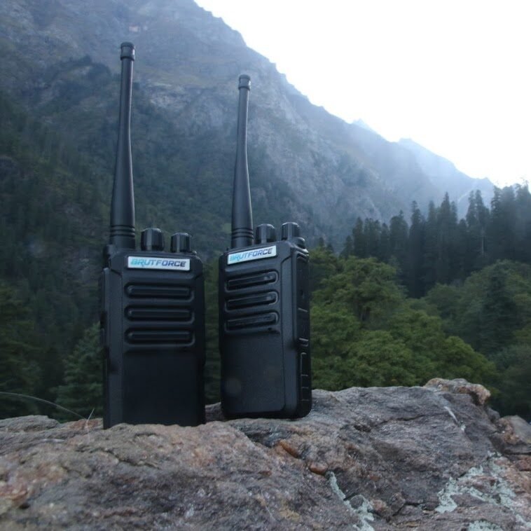
The walkie-talkie is a small, portable two-way radio device, forest management products. It allows two or more people to talk to each other without using a mobile phone or internet.
Imagine you and your team are in a deep jungle with no mobile signal. You are on one side of a hill, and your teammate is on the other. You can simply press the button on your walkie-talkie and say:
“I have reached Point 3. Any movement seen on your side? Over.”
Your teammate will receive it instantly and reply back:
“Negative. All clear from this side. Over.”
No waiting, no signal issues, no internet required.
Used in: Navigation, mapping, locating forest assets, boundary marking.
Very useful for precise forest surveys, asset recording, mapping and forest management products.

Laser Range Finder (LRF) is a handheld device that measures the distance between you and an object using a laser beam.
It works like this:
• You aim the LRF at a tree, animal, or landmark.
• The LRF sends a laser beam to that object.
• This product calculates how much time the beam takes to return.
• Based on that, it shows the distance in meters or feet on the screen.
In simple words: LRF (forest management products) helps you know how far something is, even if it’s deep in the forest or across a river.
Trail Camera, is a unique type of automatic camera placed in forests to take pictures or videos of animals or humans when they pass in front of the camera. Such cameras do not require a human presence to take photographs. They forest management products operate 24×7, even at night, and are installed at chosen locations in the forest to watch wildlife and forest activity quietly and safely.
Storage in SD cards, and in better models, live image transfer using SIM cards (GPRS/4G).


Electric Vehicles (EVs) are proving to be green, noiseless, and efficient means in forest conservation and ecotourism. Their use guarantees reduced emissions, less noise pollution, and increased operational efficiency, which conforms to environmental conservation policies.
Fitted Accessories: Walkie-talkies, GPS, and data loggers for effective real-time communication and monitoring.
Electric Vehicles (EVs) offer a clean, quiet, and sustainable alternative for operations in forest areas. They empower forest staff with modern, noise-free patrol solutions and enhance eco-tourism by offering safe, pollution-free wildlife exploration.
In forest environments, the need for intelligent, proactive, and cost-efficient surveillance is crucial for conservation, monitoring of illegal activities, and ensuring ranger safety. Traditional CCTV systems provide visual records but lack the intelligence to detect anomalies or predict threats. AI-integrated CCTV systems overcome this limitation by combining machine learning (ML), behavior analysis, and automated alert systems tailored to forest use cases.


Drones, or Unmanned Aerial Vehicles (UAVs), are remote-controlled flying machines used for aerial monitoring, mapping, and data collection. In forestry and wildlife departments, drones offer a game-changing solution for better surveillance, documentation, and rapid response.
In forest environments, especially in remote and inaccessible terrains, timely response to accidents, injuries, or wildlife incidents is critical. A Rapid Response Rescue Kit is a compact, ready-to-deploy solution designed to empower frontline forest personnel, range officers, and eco-volunteers to handle emergencies effectively until additional help arrives.
This chapter details the core components of the Rapid Response Rescue Kit and how each element plays a vital role in saving lives and improving operational readiness in forest zones.

Login and Know more information.
A walkie-talkie is a small, handheld radio device that allows people to talk to each other using wireless signals—without the need for a mobile network or tower
GPS stands for Global Positioning System. It is a satellite-based navigation system developed by the United States Department of Defence and made available for civilian use.
Differential GPS (DGPS) enhances the precision of GPS location using a chain of ground stations, which calculate and relay the corrections to the GPS receiver and achieve better precision ranging from tens of meters up to a few centimeters.
Views: 29
We use cookies to improve your experience on our site. By using our site, you consent to cookies.
Manage your cookie preferences below:
Essential cookies enable basic functions and are necessary for the proper function of the website.
These cookies are needed for adding comments on this website.
These cookies are used for managing login functionality on this website.